Understanding the Importance of a Trail Map
Trail maps serve as essential tools for outdoor enthusiasts, particularly hikers and adventurers seeking to explore trails effectively. They provide crucial information about terrain, distances, elevation changes, and points of interest, ensuring a more enjoyable and safe experience. Whether you’re navigating an unfamiliar path or planning a scenic route, utilizing a well-crafted trail map can make all the difference.
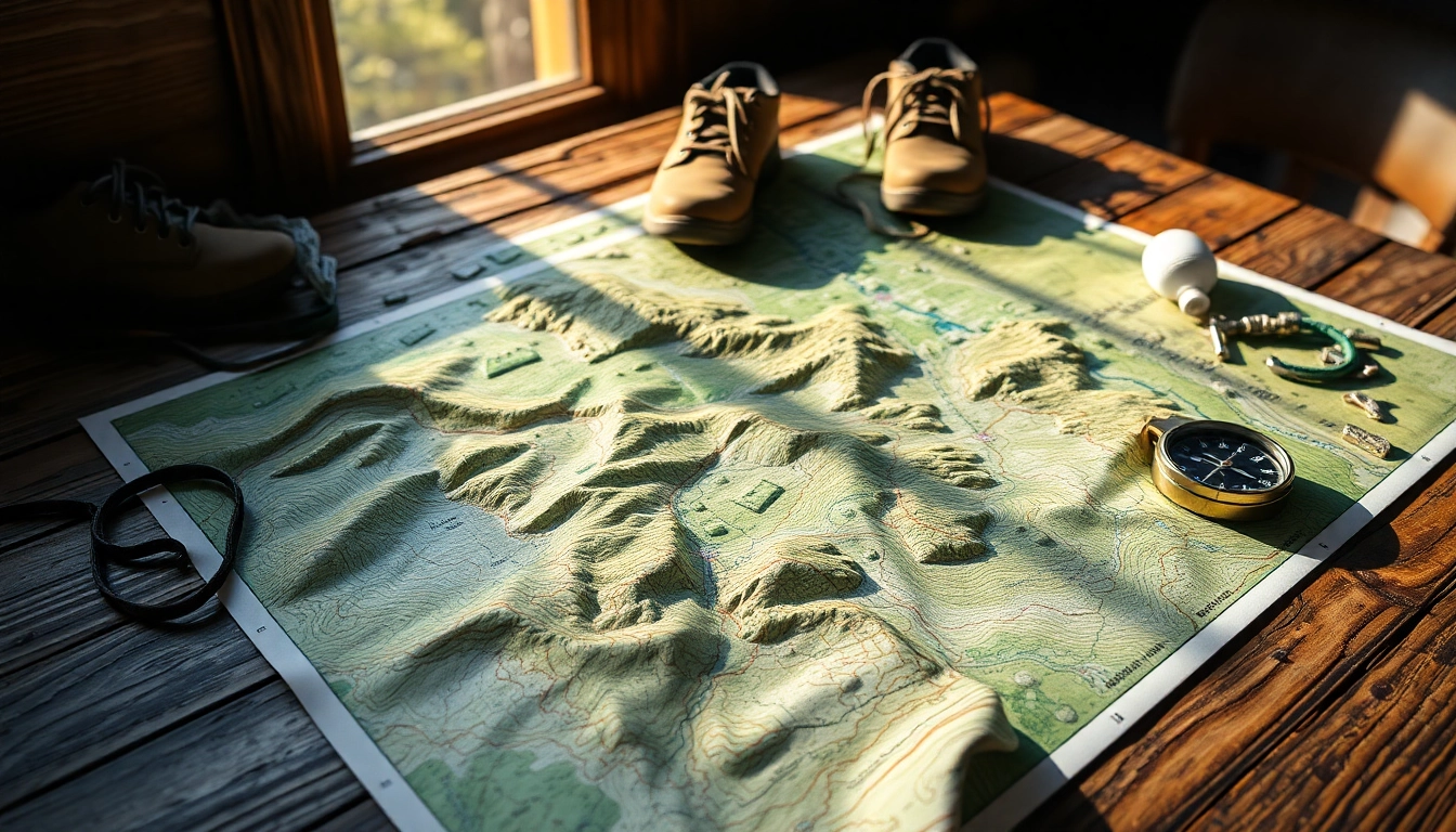
What is a Trail Map?
A trail map is a graphical representation of hiking trails, parks, and outdoor recreational areas. These maps vary in complexity and detail, often including important features such as:
- Trailheads and access points
- Trail lengths and estimated times
- Elevation profiles
- Landmarks and geographical features
- Camping areas and amenities
Trail maps can be physical or digital, each with unique advantages and challenges. Understanding the specifics and usability of different formats helps users to choose what best fits their hiking needs.
Benefits of Using a Trail Map for Hikers
Using a trail map comes with numerous benefits, including:
- Navigational aid: With a trail map, hikers can easily verify their location and find their way, minimizing the risk of getting lost.
- Safety: Knowledge of terrain and potential hazards can significantly enhance safety while hiking.
- Planning and insights: Maps allow for better route planning, showcasing points of interest, alternative paths, and estimated times to cover distances.
- Environmental awareness: Many trail maps provide information on local flora and fauna, helping hikers appreciate the natural surroundings.
Types of Trail Maps Available
Trail maps come in various formats and uses, including:
- Topographic maps: These maps are great for understanding elevation changes and geographic features, ideal for hikers in rough terrains.
- Digital maps: Accessible via mobile apps and online platforms, digital maps often include real-time GPS tracking, updates, and user-generated information.
- Printed maps: Traditional paper maps can be convenient for those who prefer non-digital solutions and are useful in areas without cell service.
- Custom maps: Personalized maps can be created for specific trails or for documenting unique routes designed by individual hikers.
How to Choose the Right Trail Map
Selecting the appropriate trail map is crucial for enhancing the hiking experience. Factors to consider include:
Identifying Your Hiking Goals
Your hiking objectives significantly influence the type of trail map you need. Consider the following aspects:
- Distance and duration: Are you planning a short day hike or a longer backcountry excursion?
- Difficulty level: Choose maps that align with your fitness and experience levels, showcasing trails that match your skills.
- Type of terrain: Different terrains may require specific features (e.g., climbing routes, river crossings).
Assessing Trail Map Features
When evaluating trail maps, look for these key features:
- Clarity and readability: Maps should be easy to read with clear markings and legends to denote paths and features.
- Scalability: Ensure the map is detailed enough to provide insights at various zoom levels, especially for digital maps.
- Updates and accuracy: Check if the map reflects recent changes in trails, closures, or local conditions.
Comparing Digital vs. Physical Trail Maps
Both digital and physical trail maps have their pros and cons:
- Digital maps:
- Pros: Real-time tracking, ease of updates, interactive features, and accessibility on multiple devices.
- Cons: Dependent on battery life and Internet connectivity.
- Physical maps:
- Pros: No reliance on technology or power; often easier to navigate in remote areas.
- Cons: They can become outdated, and lack interactivity or real-time features.
Creating Your Personalized Trail Map
For avid hikers, developing a personalized trail map can enhance the hiking experience and ensure the trails are aligned with their preferences.
Gathering Data for Accurate Mapping
To create a precise trail map, follow these steps:
- Research available data: Gather existing trail information from resources like parks, hiking groups, and local guides.
- Map existing trails: Mark down the trails you’ve previously explored, noting key features and personal preferences.
- Consult local guides and experts: Utilize insights from local hiking experts who can provide valuable information on lesser-known trails.
Utilizing Mapping Tools and Software
Numerous tools and software are available to assist in creating custom trail maps, such as:
- GIS software: Geographic Information Systems (GIS) can be used for in-depth mapping and analysis.
- Web-based mapping tools: Platforms like Google Maps or specialized hiking map sites can help in creating user-friendly maps.
- Mobile apps: Apps specifically designed for trail mapping can assist in tracking routes, marking waypoints, and sharing maps with others.
Designing an Easy-to-Read Layout
The layout of a map is crucial for usability. Include elements such as:
- Legends and symbols: Create a symbols chart that outlines what each symbol means clearly.
- Color coding: Use colors effectively to distinguish between various trails and features.
- Scale markers: Make sure to add scale markers to help users gauge distances efficiently.
Best Practices for Using a Trail Map
Proper techniques for utilizing a trail map can significantly improve your hiking experience.
Reading Topographical Features
Understanding the topography is critical in hiking. Pay attention to:
- Contour lines: These lines illustrate the shape and elevation of the terrain; closely spaced lines indicate steep areas.
- Elevation points: Identifying peaks and valleys can assist with planning ascents and descents.
- Water features: Rivers, streams, and lakes are essential for both navigation and hydration planning.
Planning Your Hiking Route Effectively
Effective route planning involves:
- Setting a start and end point: Clearly define your starting point and destination on the trail map.
- Checking for rest points: Look for resting areas or campgrounds along your route for breaks.
- Time estimates: Evaluate the total time needed based on your pace and the trail’s difficulty.
What to Do in Case of Getting Lost
Despite meticulous planning, there may be instances where hikers find themselves off course. Here are strategies to help:
- Stay calm: Remaining calm aids in better decision-making.
- Return to the last known point: If possible, retrace your steps back to where you last felt oriented.
- Use landmarks: Identify natural landmarks to assist in navigating back on course.
- Communicate: If you have a party with you, discuss your options openly for collaborative decision-making.
Enhancing Your Outdoor Experience with a Trail Map
Utilizing a trail map is not just about navigation; it enhances the overall outdoor experience through thoughtful integration of various elements.
Incorporating Waypoints and Points of Interest
Adding waypoints allows you to document interesting features like scenic overlooks, wildlife spots, or historical landmarks. Keep these points in mind:
- Documentation: Note specific GPS coordinates for easy reference and revisit on future trips.
- Sharing experiences: Use your map to recount stories and experiences to friends and fellow hikers.
- Encouragement: Waypoints can serve as motivations, reminding you of the intriguing stops along the way.
Documenting Your Trails and Experiences
Creating a record of your hikes offers benefits such as:
- A personal journal: Capturing details about each hiking experience helps in remembering the journey.
- Assessing progress: Documentation can show improvements in fitness levels and outdoor skills.
- Sharing with others: Your documented experiences can serve as inspiration for others looking for trail recommendations.
Sharing Your Customized Trail Map with Others
Collaboration and sharing enhance the community of hikers. Consider these options:
- Social media: Use platforms to share your maps, inviting others to explore the trails with you.
- Hiking groups: Share your customized trail maps within hiking clubs or online interest groups.
- Workshops and meetups: Organize gatherings to discuss and trade personalized maps with other hikers.